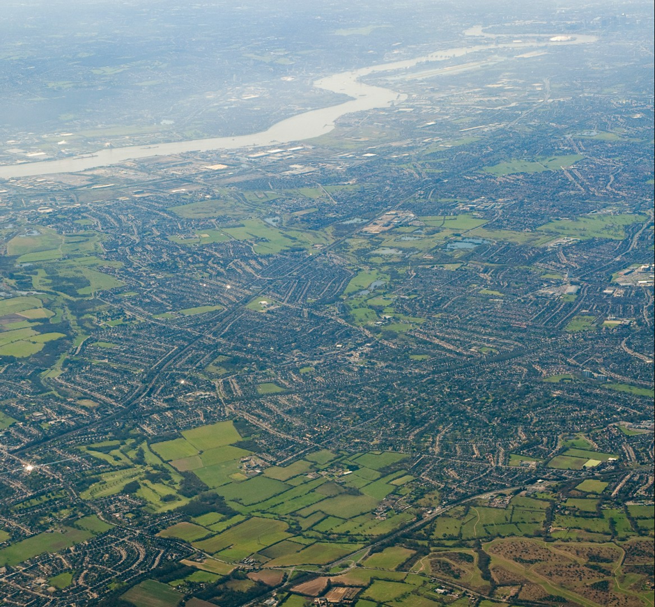
Great Green Routes
Explore London’s amazing green spaces by walking, wheeling or cycling green routes.
Whether you’re looking for day-out ideas, shorter walks, cycles, or would just like to get from A to B in a green environment, we’re here to help. Great Green Routes brings together and promotes information about London’s green walking, cycling and wheeling routes, including where to find route maps and route-finding apps. This isn’t (yet!) concise or definitive and we would welcome suggestions for additions.
CPRE London is campaigning for Great Green Routes in London
![]()
- The complete Walk London network now exists within the GoJauntly app.
- The London Footways project offers the option of quiet and enjoyable walking routes in Central London, connecting places of interest with transport hubs and greenspace and it hosts Footways Nature Trails.
- The national SlowWays project now has an almost fully verified Central London network of routes which take you from A to B along surprisingly pleasant routes.
- London Ramblers offer led walks or you can find your own walks via their app.
- The National Cycle Network offers fully accessible pathways that can be both walked or wheeled across the entirety of Greater London and beyond.
- Waymarked Trails : Hiking. A wonderful collection of routes mapped out in OpenStreetMap. The routes include the Walk London Network and others like Greenwich Meridian Trail, The Beverley Brook Walk and The Waterlink Way.
………………………………………………………………………..
Great Green Routes
CRPE London is campaigning to improve London's countryside and people's access to it. Great Green Routes is a collection of inspirational walking trails and paths that can be followed using printed maps or digital apps. We welcome any additions to this page in the form of new or established walks.

There are seven routes that form the Walk London Network, one of the largest walking networks of any city in the world. These routes are specifically designed to be easily accessible by public transport and you can walk as little or as far as you want by walking them in sections.
You can download a map and written directions for each of the sections that make up the Walk London Network routes, or follow the routes step-by-step using the Go Jauntly walking app.
London Nature Trails
Created by Footways, these four walking routes uncover a whole of urban nature.
Follow the routes on your phone using the Footways digital map or via the Go Jauntly app.
Use London Wildlife Trust’s spotter guide to discover animals and plants as you walk.
Wanstead to Royal Docks
Burnt Oak to Wembley
Swiss Cottage to King’s Cross
Bermondsey to Brockley
Short walks
To celebrate the 20th anniversary of Transport for London in 2020 GoJauntly curated 20 brand new 20 minute routes across London. Follow them via the GoJaunlty App.

Footways is a network of quiet and enjoyable routes for walking in London. The Footways network has been designed to connect major places with appealing and accessible streets. The places include mainline train stations, popular destinations and green spaces. It prompts Londoners and visitors to choose walking as the most enjoyable, efficient and healthy option.
A copy of the beautiful printed map, designed by Applied, online and in store from Stanfords. The routes can also be followed from your phone using the digital map. A series of Inspiration routes have also been created that can be followed using digital maps.
- Victoria to Trafalgar Square Waterloo to British Museum
- Euston to Soho
- King’s Cross to Covent Garden
- Liverpool Street to Tate Modern
- London Bridge to Southbank Centre
- Paddington to Exhibition Road
- Farringdon to Angel
- Charing Cross to Oxford Circus
Switch a journey to walking and see Hackney differently with Footways. This map connects Hackney Central and other major places with welcoming, appealing and accessible streets. Use the digital map to explore the area’s history and culture as you walk.
Walk to Hackney Central – Inspiration Routes
Here are some of Footways’ favourite walking routes to Hackney Central with features to uncover on the way.
The Ramblers help everyone, everywhere, enjoy walking and protect the places we all love to walk. We are the only charity dedicated to looking after paths and green spaces, leading walks, opening up new places to explore and encouraging everyone to get outside and discover how walking boosts your health and your happiness.
The Inner London Area of the Ramblers is made up of ten groups located in London. It is just one of many areas that make up the national organisation.
The Inner London Ramblers have updated guides for 2023 for The London Loop and Capital Ring.
Rambler volunteer, Mike Biggs, has put together a number of walks around London that might take you to places you’ve never been or offer views of familiar things from different angles. All the walks are regularly checked and revised where necessary. Each is designed to be followed without the need for maps or other aids.
A proposal for six new walking routes that link green spaces and bring nature closer to Londoner.

Slow Ways are creating a network of walking routes that connect all of Great Britain’s towns and cities.
Slow Ways is an initiative to create a national network of walking routes connecting all of Great Britain’s towns and cities as well as thousands of villages.
Using existing paths, ways, trails and roads, people can use Slow Ways routes to walk or wheel between neighbouring settlements, and combine them to create longer distance trips. It’s designed to make it easier for people to imagine, plan and go on walking journeys.
There are currently over 8,000 Slow Ways stretching for over 120,000km. This network of routes was created by 700 volunteers during the Spring 2020 lockdown, creating a unique Slow Ways map in the process.
London already has a nearly fully verified set of walking routes. Using the routing tool you can map your walk across London.
Here’s a couple of examples;

Slow Ways London Swarm Route
Creating your own waylists is easy. This route from Coulson to Victoria Station was created during a "Swarm" weekend. The video showcases the walk.
View Waylist
The National Cycle Network is a UK-wide network of signed paths and routes for walking, cycling, wheeling and exploring outdoors.
If you’d like to see routes across the UK on an interactive map, head over to the Ordnance Survey website

How can we create an inspiring network of great green walking and cycling routes in London?
In November 2022 Sustrans brought together three expert speakers to discuss how London can create an inspiring network of great green walking and cycling routes.

A wonderful collection of routes mapped out in OpenStreetMap.
The routes include the Walk London Network and others like Greenwich Meridian Trail, The Beverley Brook Walk and The Waterlink Way
Long Distance Walkers Association
The London Parks Way has been designed as an attempt to produce a comprehensive walking route through many of London’s parks, beginning at Kingston station and finishing at the Cutty Sark at Greenwich. This London Parks Way passes through the Royal Parks of Bushy Park, Richmond Park, Kensington Gardens, Hyde Park, Regents Park, St James Park, and Greenwich Park as well as Hampton Court Park, Holland Park, Victoria Park and Queen Elizabeth Olympic Park. If you walk the London Parks Way you will also see some of the prettiest sections of the River Thames, walk along the Regents Canal, see the regeneration of London Docklands, visit a traditional London street market, and pass through a city farm. Most of the sites used in the hugely successful 2012 Olympic Games will be seen on this walk.
The Green London Way is a long distance footpath for London, and one of the earliest urban promoted walking routes, dating to 1991. It is a circular route of about 100 miles, not around London but through it. It brought the idea of the long distance way right into the country’s largest city. At the same time it is a route which divides into 18 separate and easily manageable walks, each with its own distinctive character. The Green London Way links river and canal, towpath and abandoned railway line, urban footpath and little-known alley, park and common, woodland and heath. It is an introduction to the best and most beautiful of London’s open spaces. The 18 separate walks vary in length from 3 1/2 miles to 10 1/2 miles, beginning and ending at points well served by public transport. The website gives updates to route sections where diversions are needed, as in the Olympic Park area (in 2012).
Apps, maps and walking resources
 Go Jauntly
Your walking app for everyday outdoor adventures
Discover nature-filled walking routes.
Enjoy fun new walking challenges and more.

All the mapping you’ll ever need!
Use world-renowned Ordnance Survey mapping with unlimited use of every OS Explorer and OS Landranger map for the whole of Great Britain. That’s instant access to 607 maps to view, print, or download to your phone – all included in your subscription.

Leading you through the urban forest, TreeTalk is brought to by three London explorers: Steve Pocock, Paul Woodand Rob Tustain.
There are currently over 800k trees featured with the functionality to create greener, tree-lined walks through the points on the map.

Trails that fit your nature
Whether you’re pushing your limits or pushing a pram, All Trails have got you covered. All of the trails are verified by experts and reviewed by our global community of adventurers like you.

Access over 1 million Premium routes and content from outdoor experts
Plan your own routes from a variety of activities
Be safe with the best maps, trail networks and current conditions
Discover the world with our Travel Guide.

The TiCL App is an exciting new way to FIND and COMMENT ON things around you.