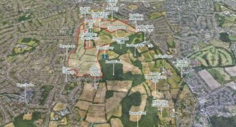
London’s Green Belt and Metropolitan Open Land

We have mapped all of London’s Green Belt and Metropolitan Open Land
Working with Greenspace Information for Greater London (GiGL) in 2018 we mapped all of London’s ‘protected land’ – Green Belt and Metropolitan Open Land. This reveals that over 22% of the area of London was designated Green Belt and almost 10% was Metropolitan Open Land.
Further details, including maps and tables showing the distribution of this land between London’ boroughs, is set out in the full report below: