Stag Brewery - help us save precious green space and reduce car parking
Save Watney Sports Ground – and no more cars in Mortlake – say campaigners
CPRE London has today (24 September 2020) written to the Mayor to object to two key aspects of the proposed development at the former Stag Brewery site in Mortlake. The Mayor is holding a public consultation until 27 September 2020 having resolved to determine the application himself.
“We are asking people to write in response to the public consultation for two key reasons – because historic green space in under threat, and because the over-provision of private car parking in the development will drastically worsen congestion, pollution and road danger in an area which already has appalling traffic problems.” Said Alice Roberts, Head of Green Space Campaigns at CPRE London.
Their detailed reasons and suggested paragraphs for people to use are set out below.
Please write to theformerstagbrewery@london.gov.uk by 27 September 2020. Suggested paragraphs below.
The revised application still proposes building on precious, historic green space. This cannot be justified by claiming the space has been re-provisioned elsewhere in the development because these new spaces do not perform the same amenity function.
• The development will see the historic Watney playing field partially built on, in an area already with extremely limited amenity space – and with a doubling of the local population once the development is complete. This will exacerbate the deficiency of open /green space.
• The justification made i.e. that space is re-provisioned elsewhere, ignores the special qualities of this space i.e. quantum, quality, openness (cumulatively tested). The new spaces proposed are not green spaces which could be enjoyed i.e. for someone to sit out in an open space in nature (a park) or for playing formal or informal sports / kicking a ball around with a child.
• Questions have already been raised about the need for this new school given declining need for places.
What needs to change
• An alternative location must be found for this school within or outside the development – to save the main green space available for a Mortlake population twice its original size. Given declining need for school places, it is likely these can be accommodated within other schools locally anyway.
The revised application (despite reducing car parking spaces) still contradicts the Draft London Plan (see our original representation) and the Mayor’s Transport Strategy.
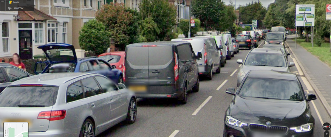
• 428 residential/visitor parking spaces are proposed in this 1,250 unit development wedged between the river and a railway line with existing appalling traffic problems. (This figure excludes the 50 disabled parking spaces planned).
• 5000sqm is dedicated to private parking which could be used for sustainable transport hubs instead.
• Richmond cannot afford to add more cars into the borough – it will a severe negative impact on Richmond’s ability to meet its TfL ‘healthy streets’ targets including for car ownership.
• No Car-Club spaces are proposed at all – this is only mentioned on the very last line of the parking document – and these are placed on a public highway (Ship Lane) – not within the development.
What needs to change
• This development should be ‘car-free’ (no private car parking) with only disabled and car-club parking.
• The development should be based on car-club, public transport, walking & cycling: this should apply to residents and visitors. A Low Traffic Neighbourhood should be introduced removing through-traffic from the entire area bounded by the river, Clifford Ave, A205 Sheen Lane/Upper Richmond Rd and Rocks Lane/Castlenau.
• Convert the 5000sqm currently dedicated to private car parking, to be used for sustainable transport hubs instead and /or car club spaces (which should NOT be placed on the public highway).